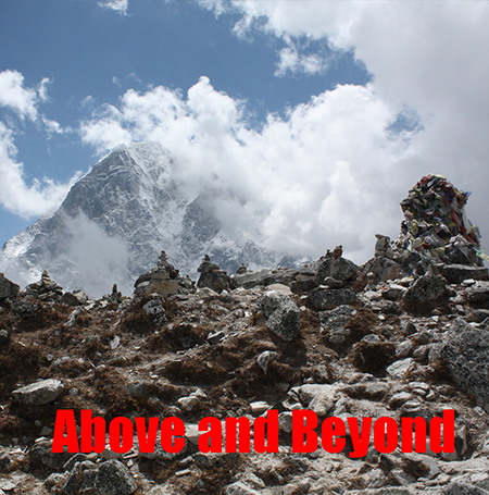
Almost a step too far.

The Everest 100 (October 2025)

The Ultimate Descent

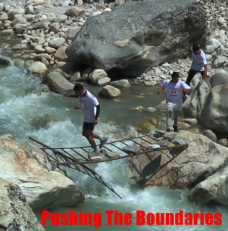
Pushing The Boundaries

Descending from an altitude of 5,164 meters at Gorak Shep, to an altitude of 1905 meters at Jiri, 100 miles down the trail. With a 3500 meter pass thrown in for good measure.

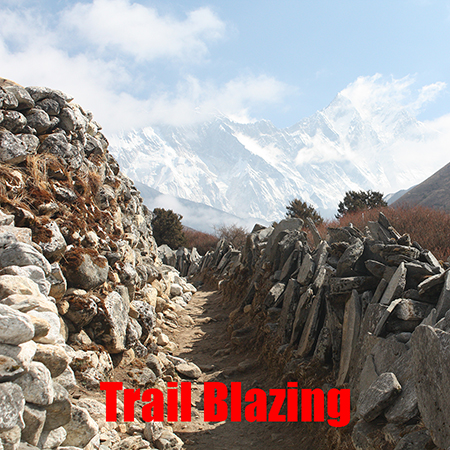
This is a classic trail run through set checkpoints.

Learn as you trek.

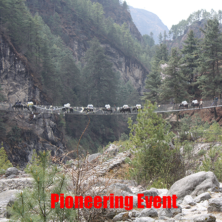
The fact that the race is on the same route as the trek up to Everest enables runners to learn the course.

Aims

To create a sustainable annual event that will challenge athletes and to support the local communities where the event is held.

Protecting the environment

We will be limiting numbers and adhering to eco friendly tourism.

For this event to be successful it will need to protect the environment where it is held and be a benefit to the local communities.

Tourism and Commerce

We see this event as a way to responsibly develop tourism in Nepal and to create employment for Nepalese people. All money raised through this event will enter the Nepali economy and Nepalese businesses.

Course

Click on maps for larger size.

This map gives you an idea of the course. A more accurate map can be seen here.


Measuring a course in the Himalayas is notoriously difficult but this is as close to 100 miles as we can make it.

Kit Drops and Drink Stations.

Be prepared to be self sufficient, especially if you do not know the course. We will be setting up check points that all participants must register at to be deemed to have completed the event. Drinks and food will be provided at these stops.

We will have two kit drops, one at Ghorepani and one at Birethanti. You will be advised as to how these will be organised later (on this website).

Safety

We want to provide a challenging event but most of all we want it to be safe. Familiarisation with the course id the best way to ensure your safety. Failing that, it is important to pay special attention to the minimum kit list. With kit drops it is possible to make provision to pick up certain items such as head torches, at the appropriate time. That also relies on people staying on schedule and that must be a consideration.

Although the lower part of the course is accessable by road, the more challenging part of the course from Birethanti to Ghorepani is not. This part of the race is inhabited and the local residents will be aware of the event. Should anyone have a problem in this section they will need to make sure they have appropriate clothing and provisions to survive until we can reach them. It is difficult to get lost in this section of the race.
Checkpoints

The checkpoints should ensure that everyone is accounted for, which is why it is mandatory for all participants to ceck in at them.

Organisors

Between us we have been reponsible for creating and organising: The Everest Marathon, The Annapurna Triathlon, The Kathmandu Marathon, The Annapurna 100 and The Everest Ultra.

Package

The event is based on an all inclusive package.

Trekking the course.

By trekking up the course, the runners will familiarise themselves with the terrain.

There is also another very good reason to do this. The runners will become acclimatised for the event as they trek and at the same time maintain their fitness for the event.

Board and Lodging

We will be trekking from village to village and our accommodation will be in teashops so we support the local economy. Where beds are short we will suppliment the accommodation with tents which will add to the adventure.

Itinerary

The event is based on an all inclusive package.

Trekking the course.

  • Day 1: Welcome to Kathmandu
    Alt: 1300 m / 4265 ft
  • Day 2: Drive to Shivalaya
    Alt: 2190 m / 7185 ft – 8 to 10 hrs
  • Day 3: Shivalaya to Sete
    Alt: 2575 m / 8448 ft – 6 to 7 hrss
  • Day 4: Sete to Jun Beshi
    Alt: 2670 m / 8759 ft – 6 to 7 hrs
  • Day 5: Jun Beshi to Nunthala
    Alt: 2220 m / 7283 ft – 6 hrs
  • Day 6: Nunthala to Bupsa
    Alt: 2360 m / 7742 ft – 5 to 6 hrs
  • Day 7: Bupsa to Surke
    Alt: 2290 m / 7513 ft – 5 to 6 hr
  • Day 8: Surke to Phakding
    Alt: 2652 m / 8700 ft – 4 to 5 hrs
  • Day 9: Phakding to Namche Bazaar
    Alt: 3440 m / 11286 ft – 5 to 6 hrs
  • Day 10: Acclimatization Day
    Alt: 3440 m / 11286 ft
  • Day 11: Namche Bazaar to Tengboche
    Alt: 3870 m / 12696 ft – 5 to 6 hrs
  • Day 12: Tengboche to Dingboche
    Alt: 4360 m / 14304 ft – 5 to 6 hrs
  • Day 13: Dingboche to Thukla
    Alt: 4600 m / 15091 ft – 3 to 4 hours
  • Day 14: Thukla to Lobuche
    Alt: 4940m / 16207 ft – 3 to 4 hrs
  • Day 15: Lobuche to Gorakshep (Afternoon hike to Kalapatthar)
    Alt: 5368m / 17611 ft – 7 to 8 hrs
  • Day 16: Acclimatisation Day
    Alt: 5545m / 18192 ft –
  • Day 17: RACE DAY
  • Day 18:RACE DAY
  • Day 19: Bus to Kathmandu
  • Day 20: Prize Giving

Board and Lodging

We will be trekking from village to village and our accommodation will be in teashops so we support the local economy. Where beds are short we will suppliment the accommodation with tents which will add to the adventure. You will be expected to have your own sleeping bag.

A kit list will appear here in due course.

Application

Our numbers are strictly limited to 100 participants.

This is not an entry level event.

To be accepted on this event you will have to show proof that you have completed a recognised 100 mile event.

Much as people desire to take part in this event, it is important to realise that inexperience is a danger not only to your safety but also the safety of others tasked to rescue you. The first part of the race is at altitude with further climbs into altitude along the lower route.

Rescue

Helicopter rescue is not always possible and portering on a stretcher is a risk to the support crew.

Get In Touch

Got any questions? Don't hesitate to get in touch.

Phone

+44 7742931618

© 2023 Locus. All rights reserved.